publications
Mapping the Forgotten Colony: the Ogasawara Islands and the Tokugawa Pivot to the Pacific
Cross-Currents: East Asian History and Culture Review 6, no. 2 (December 2, 2017): 440–90. https://doi.org/10.1353/ach.2017.0015.
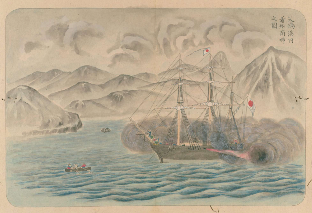
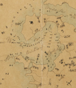
In 1862, Japan’s Tokugawa shogunate claimed the Ogasawara Islands, a small archipelago between Honshu and Guam, as a part of Japan. In the manageable setting of the islands, the shogunate undertook a colonial experiment that revealed changing attitudes toward non-Japanese ethnicities, modern technologies, and maritime space. Through an examination of four maps, this article shows that Japanese intellectuals had been discussing plans for settler colonialism in the Pacific almost a century before Tokugawa leaders began exploring the open sea as an economic space. In the shogunate’s two-tiered strategy, agriculture assimilated the land, and law subjected its earlier settlers. This approach provided a foothold for offshore whaling, which transformed the surrounding seas into a space of production. However, expanding the sphere of Tokugawa influence necessitated a redefinition of the Japanese realm. Geographical notions were reshaped to make the overseas territory a part of the Izu archipelago some 700 kilometers farther north, and the presence of Western settlers was countered with narratives of earlier possession and relocation of Japanese individuals. Officials were particularly intrigued by formerly unknown plant and animal species found on the islands. Exploring economic opportunities in the Pacific sphere, they prepared a geopolitical shift that is often associated with Japan’s modern empire. This article, by contrast, locates the origins of modern Japan’s “pelagic empire” well before the Meiji Reform and shows how expansionism was reconciled with earlier perceptions of geography.
.